Redhill
| Target: | Gold-Copper-zinc VMS & structurally controlled gold |
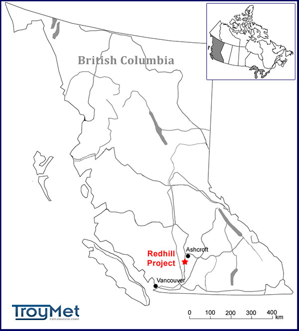
| Location: | 10 km south of Ashcroft, British Columbia |
| Property: | 18 mineral claims totalling 3,689 ha |
| Ownership: | Bessor holds an option to earn 100% |
Highlights
The Redhill project is prospective for gold-copper-zinc volcanogenic massive sulphide ("VMS") and structurally controlled gold mineralization. The volcanic sequence of the Redhill sector is exposed in a 5 km wide, NNW-striking thrust slice over a distance of at least 20 km. The geology is interpreted to be chemically analogous and age equivalent to the Permo-Triassic age Kutcho Assemblage that hosts the Kutcho Creek Cu-Pb-Zn-Ag VMS deposit in northern British Columbia. New exploration and targeting concepts have identified new drill targets in the Alpha, Beta and Alpha South zones.
Current Status
Bessor holds a multi-year permit for its diamond drilling program on the Alpha and Beta zones. The Company’s 2015 field program on the Alpha zone identified several VMS targets that have associated electromagnetic (EM) conductors and copper- and zinc-in-soil anomalies. The program also outlined a ~900 m x ~250 m gold-in-soil anomaly. In 2016, Troymet completed a three dimensional induced polarization (“3DIP”) survey over the strongest EM anomalies, the gold-in-soil anomaly and the high-grade intersection in 2006 drill hole, RH06-25. Detailed follow-up soil sampling and prospecting of multiple 3DIP anomalies identified new drill targets and expanded the area of prospective volcanic stratigraphy.
A 5 hole (1,003 metre) drill program completed in October 2016 tested VMS targets on Horizons 2 and 3 of the Alpha zone and resulted in the discovery of a significant new zone of copper-rich VMS. Drilling also intersected the extension of the high-grade mineralization in hole RH-06-25, and demonstrated that the mineralization is relatively shallow and open on strike and to depth.
The Company completed a test gravity survey over the area in June 2017, which identified strong anomalies associated with the VMS zones and supported belief that significant VMS mineralization likely occurs at depth in the Upper and Lower VMS zones and that an untested mineralized mass also exists at depth. The Company is looking forward to resuming exploration on the significant targets it has identified.
Previous Work
The Red Hill property has been intermittently explored for porphyry copper-molybdenum mineralization, magnetite copper-gold skarn mineralization, and copper-zinc-silver-gold VMS deposits. Most of the modern exploration was carried out by Noranda, Rea Gold, BP Selco, Cominco, Teck Corporation and Avalon Ventures Ltd.
BP Selco conducted limited drilling on the property in 1983-84. Drill hole S83-4 intersected stringer zone mineralization on the historic Feedlot (Beta) zone, returning a best intersection of 2.54% copper, 2.78% zinc, 77.0 g/t silver, and 0.37 g/t gold over 7.75 metres (BC ARIS Report #28371). Drilling by Rea Gold from 1985 to 1988 included 6 core holes and 9 percussion holes. Teck Corporation drilled 22 core holes in 1998 and 2001, primarily concentrating on the Feedlot (Beta) zone. In 2005, Avalon Ventures drilled 3 core holes on the Feedlot (Beta) zone and 3 on the Redhill (Alpha) zone. Avalon contracted a TEM survey over the Redhill (Alpha) zone in 2006, identifying 11 EM conductors over a ~600 m x 1,100 m area. Borehole EM surveys were also conducted on Avalon's 3 core holes at Redhill, detecting an off-hole TEM conductor in RH-05-23. Avalon subsequently drilled 4 holes to test the off-hole conductor. RH-06-25 intersected massive sulphide mineralization returning 10.15% copper, 5.45% zinc, 1.41 g/t gold and >30 ppm silver over 1.74 m. A borehole pulse EM survey on RH-06-25 identified a new, strong off-hole conductor in the vicinity, which to date has not been tested by drilling.
Alpha Zone
The Alpha zone encompasses a 2.0 km x 2.5 km sequence of felsic to intermediate volcanics that include the historic Redhill zone as well as an extensive area of untested copper-zinc-silver soil anomalies. The alteration and mineralization within the volcanic sequence is interpreted to represent a stringer zone in the footwall of a VMS exhalative system.
A primary target at Alpha is an untested, off-hole pulse EM conductor in the vicinity of 2006 diamond drill hole RH-06-25, which intersected massive sulphide mineralization grading 10.15% copper, 5.45% zinc, 1.41 g/t gold, and >30.0 g/t silver over 1.74 m. The Company has confirmed the mineralized intersection with visual inspection and re-assaying the core. Frontier Geosciences Inc.was retained to review the results of the surface TEM survey conducted on the Alpha zone in 2005. Frontier’s review determined that the gold-rich, high-grade copper intercepts in holes RH05-23 and RH06-25 were not detected by the TEM survey, indicating that two separate zones exist in this area. Consequently, the intercepts in these holes may be part of a deeper, high-grade zone(s) of VMS mineralization. In addition, historical drillng was concentrated in the centre of the TEM grid; however, the stronger TEM responses occur in the southeastern and northwestern areas of the grid and have not yet been tested by drilling.
The Company completed a B-horizon soil sampling program over the Alpha zone in September 2015. A strong copper response is noted in the vicinty of holes RH05-23 and RH06-25. There is also a strong copper response associated with EM conductors PT1 and PT2, and down slope to the southwest of conductor PT1. The association of EM conductors with copper-in-soil anomalies indicates there are additional prospective sequences that have not yet been mapped or recognized. In contrast to copper, the stronger gold values occur, consistently, line-to-line over a distance >1,000 m. The gold anomaly may be reflecting an unrecognized prospective volcanic sequence or it may be mapping a hitherto undiscovered mineralized structure.
A three dimensional induced polarization (3DIP) survey completed over the Alpha zone in May 2016 mapped a domain of high chargeability and resistivity along the west side of the grid at a depth of ~200 metres (Section 1600N, Chargeability & Resistivity). Plentiful breccia boulders, several of which contain massive sulphide blocks (photos: angular sulphide in breccia; bedded sulphide in breccia) have been found in a prospective volcanic sequence that is coincident with the strong, chargeability/resistivity anomaly (map: chargeability showing prospective volcanic sequences). The sulphides are dominantly of pyrite with trace to minor chalcopyrite. The boulders represent slump features and/or mechanically transported mineralization likely the result of brecciation at source, transport down-slope by gravity-driven submarine debris flows, and deposition in depressions. What is geologically termed “transported ore” can form substantial bodies of mineralization as in the Buchans and Boundary VMS deposits in Newfoundland.
The survey also identified a large chargeability anomaly over an area of ~280 X 260 metres just west of the VMS prospect, and another over an area ~ 210 X 100 metres in the southeast part of the grid. The prospective volcanics, chargeability and resistivity anomalies continue to the west beneath the adjacent valley that is transected by the Trans-Canada Highway. A 1987 percussion hole (R87-7) drilled in the valley intersected copper mineralization in volcanics, demonstrating the potential for the discovery of additional mineralization in this area.
Detailed follow-up soil sampling and prospecting of multiple 3DIP anomalies identified new drill targets and expanded the area of prospectivevolcanic stratigraphy.
A 5 hole (1,003 metre) drill program completed in October 2016 tested VMS targets on Horizons 2 and 3 of the Alpha zone (Alpha Zone Compilation; Drill Hole Locations). Hole RH16-04 intersected mineralization from 5.1 to 11.6 metres depth (“Upper Zone”) grading 0.72% copper and 6.5 g/t silver over 6.5 metres. The copper mineralization extends upwards an additional 3.8 metres to the base of the drill casing; however, poor core recovery in this interval did now allow for a reportable assay. The downhole width of the mineralized zone is estimated to be in excess of 11.5 metres. Outcrop stripping, trenching, mapping and sampling will be undertaken prior to further dril testing on the Upper Zone. Hole RH16-04 also intersected VMS mineralization from 206.3-208.3 metres downhole grading 0.64% copper and 1.5% zinc over 2.0 metres (“Lower Zone”). This intersection is ~20 metres laterally and ~20 metres higher than the mineralization in 2006 hole RH-06-25 (8.75% copper, 4.75% zinc, 1.22 g/t gold & 61.19 g/t silver over 2.04 metres). The mineralization is open along strike and to depth, and lies deeper than was tested by previous drilling in the VMS prospect.
Hole RH16-03 was drilled, in part, to twin 2005 hole RH-05-23 and to test for shallow mineralization. The best intersection (0.29% copper and 1.2 g/t gold over 1.0 metre from 33.8-34.8 metres downhole) was obtained from pyrite stringer mineralization. The high-grade mineralization in hole RH-05-23 (2.08% copper and 7.5 g/t gold) was also obtained from pyrite-chalcopyrite stringers but from ~45 metres deeper. As in the case of the intersections in holes RH16-04 and RH-06-25, this indicates the better mineralization lies deeper than was previously tested by drilling on the VMS prospect. Further details of the drilling program are presented in the Company's November 15, 2016 news release.
In June 2017, the Company completed a test gravity survey over the area where diamond drill hole RH16-04
intersected two zones of significant copper VMS mineralization (Upper
and Lower zones), and where a borehole EM survey identified a significant off-hole response in hole RH06-25. The gravity survey
identified strong anomalies associated with the Upper and Lower VMS
Zones, and, unexpectedly, with Horizon 1. The results support management's
belief that significant VMS mineralization likely occurs at depth in the
Upper and Lower VMS zones. The unexpectedly strong anomaly associated
with Horizon 1 suggests an untested mineralized mass at depth. Further details of the gravity survey are presented in the Company's August 17, 2017 news release.
Alpha South Zone
The Alpha South zone is centred on a prominent hill south of the Alpha zone. A soil sampling program conducted in September 2015 outlined a number of copper, zinc and gold anomalies ~1,200 m southwest of the Alpha zone anomalies. The strongest anomalies were prospected and pitted in July 2016. The copper and zinc anomalies appear to be associated with structures/shearing possibly associated with particular volcanic horizons, although further work is required to confirm this. The gold anomalies appear to be related to rhyolite. Sheared rhyolite in an area of anomalous gold-in-soils on the south side of the zone is altered to white clay. The rhyolite contains high levels of mercury (2,500 ppb; BC ARIS report 23423). Further work is required to evaluate the significance of the gold-in-soil anomalies and the implications of the high mercury levels in the rhyolite.
No deep penetrating TEM surveys have been conducted on the Alpha South zone and as such it is unknown if there are EM conductors associated with the anomalies. Based on available records, only two percussion holes have been drilled on the Alpha South zone. Both were shallow (less than 85 m) angle holes that tested a small geochemical anomaly near an old adit. Hole S81-5 intersecting 0.48% zinc over 6.1 m.
Beta Zone
The Beta zone (historically called the Feedlot zone) encompasses a 2.5 km x 2.5 km sequence of felsic to intermediate volcanics, graphitic sediments, iron formation +/- locally laminated semi-massive to massive sulphides containing pyrrhotite +/- pyrite +/- minor chalcopyrite. Diamond drilling by BP Selco in 1983 reportedly intersected stringer zone mineralization in hole S83-4, grading 2.54% copper, 2.78% zinc, 77.0 g/t silver, and 0.37 g/t gold over 7.75 m. (BC ARIS Report #28371). There is no existing core from this hole for re-logging or confirmatory sampling. The Beta zone appears to stratigraphically overly the Alpha zone in the volcanic sequence. Numerous EM, IP/R and magnetic anomalies are present.
The Company has been evaluating the geology, geochemistry and geophysical anomalies to identify drill targets. In reviewing EM and IP surveys, an untested, 40 mho target has been identified 200 metres south of borehole S83-4 (2.54% copper, 2.78% zinc, 77.0 g/t Ag, and 0.37 g/t Au over 7.75 metres; BC ARIS Report #28371). The 40 mho target is located on a 550 metre long EM conductor. A large chargeability anomaly is also associated with the 40 mho Beta target. The chargeability anomaly and the host conductor have never been drilled. The Company plans to drill test this target as part of the next drill program.
Technical Reports
 Property Location Map
 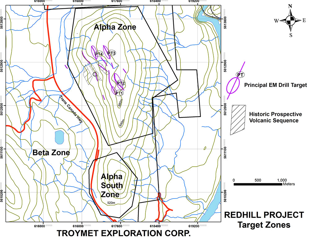 Target Zones